Wednesday
May 8, 2024 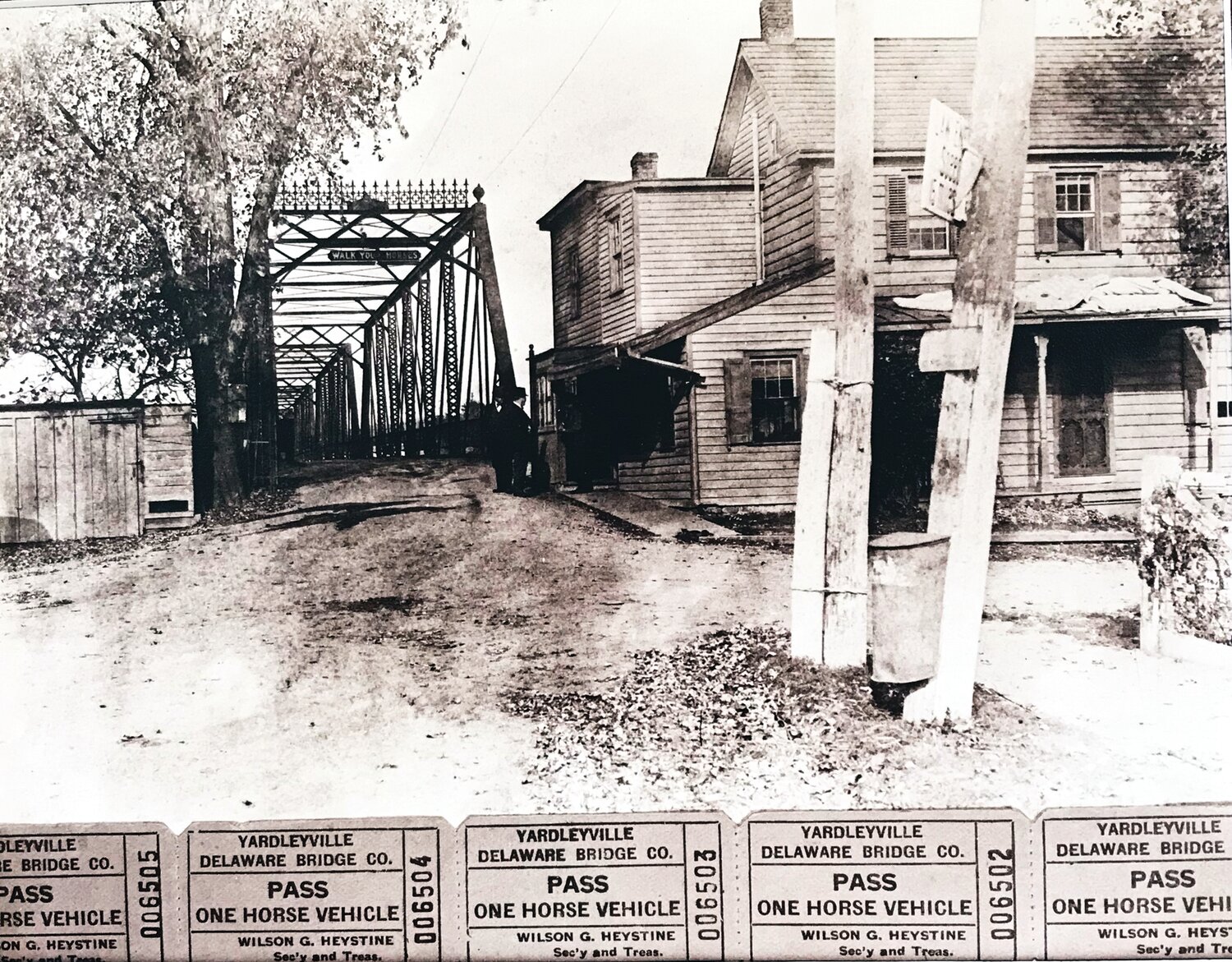


Three bodies of water — the Delaware River, the Delaware Canal, and Lake Afton — have led people to Yardley. From the first Lenni Lenape to New York City dwellers seeking post-COVID havens, Yardley and its waterways have provided sustenance and serenity.
The enduring, free-flowing Delaware River was the earliest attraction. For the Lenni Lenape, the river was sacred, as well as vital for transportation, fishing, and daily life. In the 1680s, it became equally important to the English settlers. The riverfront land sold by William Penn was laid out in a way that provided each parcel with a limited amount of frontage as well as a long rectangle running inland.
Even though the river is not navigable above the Trenton Falls, it was used for limited shipping, travel, fishing and recreation. The ability to cross the Delaware River to New Jersey became a necessity as more people settled in the area. The first ferry service was established around 1710. Then, in 1722, the Pennsylvania Assembly passed an act “to erect and establish a ferry on the lands of Thomas Yardley.”
In 1839-40, the ferry was replaced by a wooden Burr truss covered bridge. It was located at the foot of East Afton Avenue. The bridge was soon severely damaged in an 1841 flood and in 1898, when wind blew away 500 feet of roofing.
The Philadelphia Centennial Exposition was the impetus to construct a new railroad line connecting New York City to Philadelphia. Yardley was selected as the river crossing location. In 1876, just in time for the opening of the Exposition, a railroad bridge was opened at the south end of town. It was replaced in 1911 by a “magnificent” concrete arched bridge set 20 feet higher.
The railroad company promoted development. In the early 1900s, the editor of the “Village Luminary” wrote: “There is a great demand in large cities at present, for near at hand places of rural resort, where the wealthier classes may build villas to spend the summer season.” Visitors and new residents did come, drawn by the river, lake, canal, community picnics and dances. For several decades Yardley was a small resort.
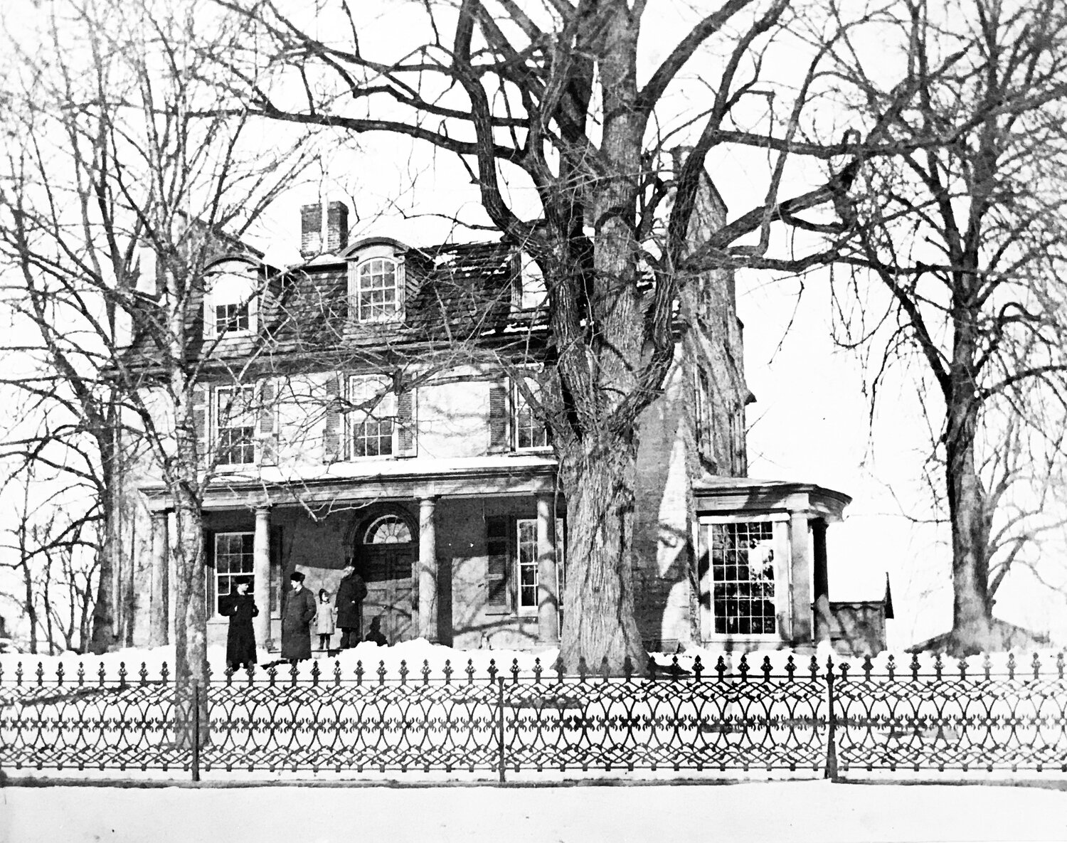
In 1908, Mary Yardley sold family property between the canal and river to the north of East Afton Avenue to Trenton developers Samuel J. Morgan and Manes A. Fuld. They named their development “Rivermawr.” Most of the small homes were built in the then-popular bungalow style.
Locals enjoyed the river scenery and used its waters for boating, swimming and fishing. There were even “beaches” along the river.
The Delaware also has its destructive side. The Delaware River Basin Commission records major floods due to snow melt, severe rainfall, Nor’easters, and hurricanes. The highest recorded crest at Trenton was in 1904 at 30.6 feet. Next was 1955 at 28.6. During these floods, Yardley was underwater from the river west to the canal.
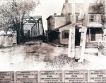
On Oct. 7, 1903, a tropical storm dumped 14 inches of rain over a four-day period. Nine river bridges were washed away. Large sections of the Yardleyville covered bridge “yielded to the mighty forces of the onrushing waters. . . and floated down the stream in sections.” It was replaced by a steel iron bridge.
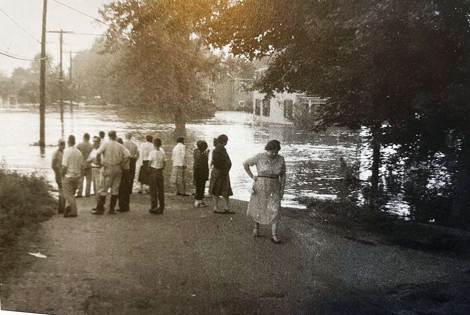
The 1955 flood is still embedded in many people’s memories. Back-to-back hurricanes caused the river to rise to near-record levels on Aug. 18-19. The muddy, turbulent rushing water was filled with debris. The Yardley bridge began to break up when it was struck by a floating bungalow, and half was swept away. Once again neighbors, friends, church groups, government agencies, fire departments and the Red Cross flooded Yardley with relief. The area was cleaned up and rebuilt.
The U.S. Army Corps of Engineers was on site quickly to erect a temporary Bailey Bridge across the river. It was opened by Santa Claus on Dec. 23, just four months after the Great Flood.
Scudder Falls, upstream from the town of Yardley, was selected as the location of the new permanent river crossing, and that bridge was opened in 1961.
For almost 50 years, there were no major Delaware River floods. The serenity of riverfront living was broken in September 2004 when remnants of Hurricane Ivan hit the Delaware River Basin. While 2004 was a surprise to many, it was repeated in 2005, 2006, and 2011.
After four major floods, affected residents in the floodplain were dealing with the Federal Emergency Management Agency, which bought a few houses and provided funds to elevate others. Today many homes between the river and canal are elevated, and the early “vacation home” character of the neighborhoods in the floodplain has changed.
The Delaware River with its pleasures and dangers has shaped Yardley.
Susan Taylor is the president of the board of directors at the Yardley Historical Association.
“Heralding Our History” is a weekly feature. Each month, the Herald delves into the history of one of its towns.
Join our readers whose generous donations are making it possible for you to read our news coverage. Help keep local journalism alive and our community strong. Donate today.