Saturday
April 20, 2024 


The stream known as Pine Run is a tributary of the Neshaminy Creek, part of the Delaware River Watershed. The Pine Run rises from a pond near Landisville in Plumstead Township, passing through Buckingham Township, Doylestown Township and New Britain, meeting with the North Branch of the Neshaminy in the Borough of Chalfont.
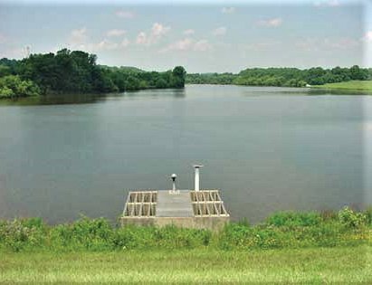
• The Pine Run watershed has been the focus of stormwater planning for over 40 years. As part of the development of a stormwater management plan, a dam was built to help to reduce the impact of flooding on downstream communities. Behind it formed a large reservoir located between Ferry Road and Sandy Ridge Road in Doylestown Township. A plaque along the bike/hike trail running through the watershed states that the 30-foot high “floodwater retarding dam” forming a 39-acre lake was constructed in 1973 by the Counties of Montgomery and Bucks and the Neshaminy Water Resources Authority.
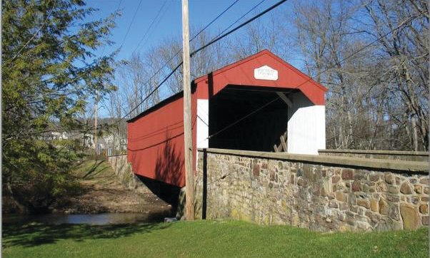
• Further downstream in New Britain, the Pine Valley Covered Bridge (also known as Iron Hill Bridge) has spanned the Pine Run since 1842. It is a “town truss” style bridge and measures 81 feet in length. Rehabilitated in 2003, it is the second-oldest covered bridge in Bucks County and is on the National Register of Historic Places.
Join our readers whose generous donations are making it possible for you to read our news coverage. Help keep local journalism alive and our community strong. Donate today.