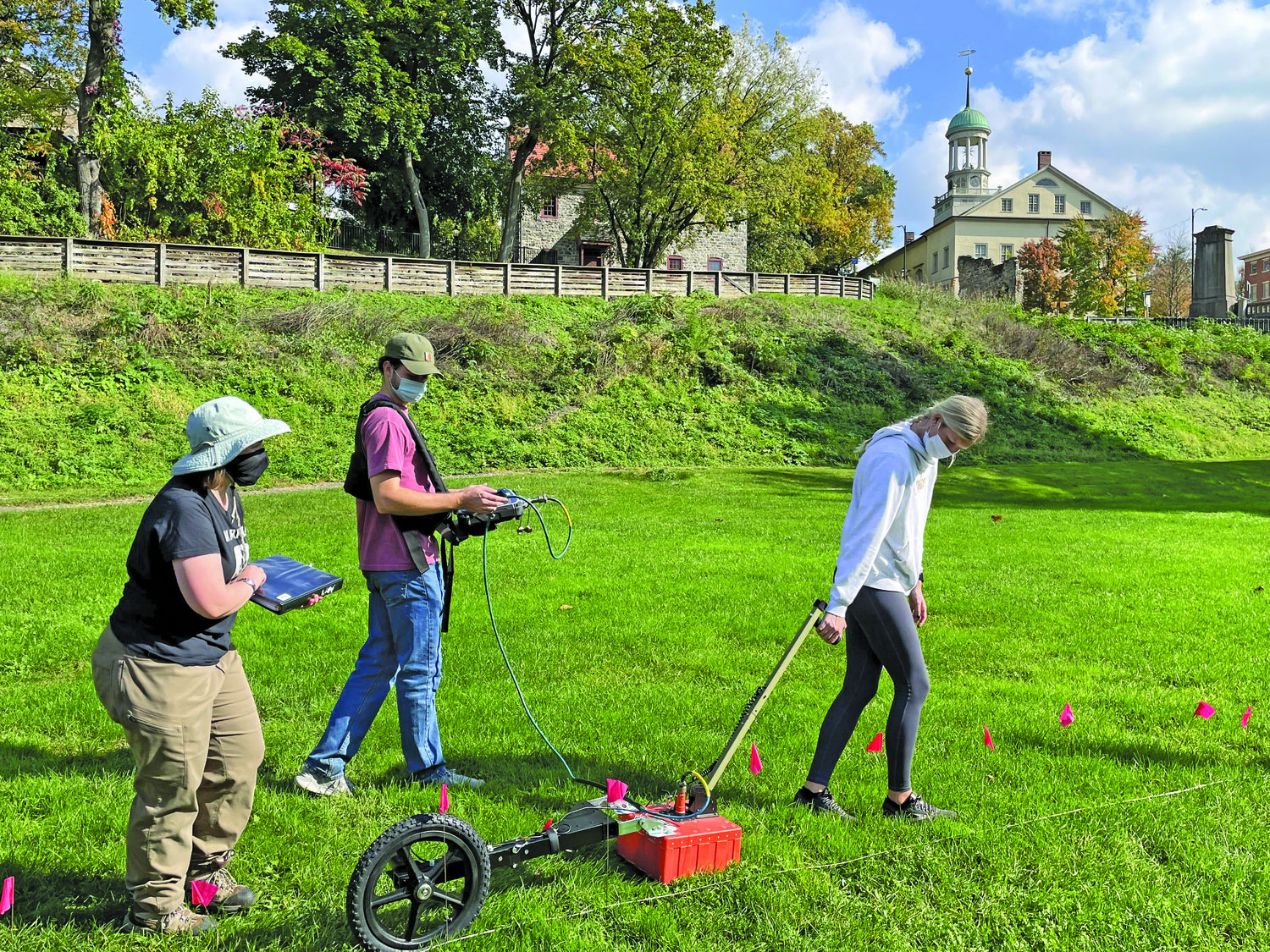


Historic Bethlehem Museums & Sites (HBMS) partnered with Lehigh University’s Dr. Mariah Hoskins to use Ground Penetrating Radar (GPR) to explore the nearby Colonial Industrial Quarter.
HBMS contacted Lehigh University’s Seismology class and Hoskins, a professor and postdoctoral researcher in the Earth and Environmental Sciences Department, to help discover remains of the old tawry, oil mill and butchery in the Colonial Industrial Quarter along the Monocacy Creek.
Relative locations of the torn down buildings are known due to exceptional record keeping. The purpose of uncovering the foundations of these buildings is to further understand and educate the public on the life of the 18th century Moravians.
The quarter can be considered America’s earliest industrial park with 35 crafts, trades and industries operating there in 1747. In the 1950s, the area unfortunately became home to a junk yard. Over the years, HBMS has transformed the site into a place to share the stories of early industry in Bethlehem.
Dr. Hoskins and eight of her students visited a cordoned-off area inside the Colonial Industrial Quarter and used a GPR device to look beneath the surface. The class did an analysis of the area between the gravel path south of the springhouse and the large tree just north of the Waterworks.
Join our readers whose generous donations are making it possible for you to read our news coverage. Help keep local journalism alive and our community strong. Donate today.
